Tuesday, July 24, 2007

Four Pass Loop - Maroon Bell/Snowmass Wilderness CO

Friday 13 July – 16 July 2007

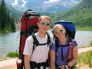
Hikers: Pat, Jodie
Weather: 40s-70s, sunny, rain showers
Miles: 28
Elevation Gain: 2,920 ft
Duration: 3 days

Jodie and I did the Four Pass Loop outside of Aspen, CO. It is a very beautiful route. We spent most of the first day getting ready and walking around Aspen. In the evening, we backpacked in 1.5 miles to Crater Lake for our first night. The next morning we hiked up and over Buckskin Pass, and then down to Snowmass Lake. All the passes on the route are fairly similar in that you hike up to them at a moderate grade and then the last bit of trail before the pass is a steep series of switchbacks that, combined with the altitude ~12,400 ft, is guaranteed to take your breath away.

Looking back from Buckskin Pass

Snowmass Lake and Trail Rider Pass

Snowmass Lake is visible from Buckskin pass, and the hike down to the lake is nice. There is a little bit of climbing just before the lake that can be hard at the end of the day. There are many established campsites at Snowmass Lake – and many mosquitoes. We brought our bug head nets so the bugs didn’t bother us too much. We hung out in the tent most of the time after dinner anyway. The bugs weren’t quite as bad next to the lake, so we did spend some time there too.

View toward Fravert Basin from Trail Rider Pass

On our second day, we climbed up and over Trail Rider Pass, which has a great view down into Fravert Basin. The descent down into Fravert Basin is long and steep at times. We made good time and were feeling strong, so we continued high up into Fravert Basin, passing a nice waterfall and several established campsites shortly thereafter. As the trail began to turn farther away from the stream, we decided we had better find a campsite before we got too high up. We found a fairly decent, not particularly flat, site that was suitable for the night. The bugs were pretty bad at this campsite as well, but not as bad as at Snowmass Lake.

The third day was our final day. We climbed up and over Frigid Air Pass, which has amazing views of the curving maroon ridge that forms the side of Fravert Basin, as well as views towards the mountains outside Crested Butte. The route descends slightly from Frigid Air Pass and then makes a downward traverse towards West Maroon Pass. The wildflowers are spectacular at all the passes, but this section has particularly tall wildflowers. Thankfully, not a lot of elevation is lost before the climb up to West Maroon Pass Begins. West Maroon Pass is a narrow rocky pass that was by far the most popular of the ones we visited. We encountered many people who were doing day hikes from Aspen or Crested Butte, or in some cases people who were doing a one-way hike from Aspen to Crested Butte.

View towards Crested Butte from Below West Maroon Pass

The descent down from West Maroon Pass to Maroon Lake went smooth, though it did seem to drag on towards the end when Jodie and I were both ready to be done. We took showers at the Aspen Rec Center before heading back into Aspen for dinner.

Back at the Maroon Bell Trailhead

Mt. Sopris (12,953ft) CO

Wednesday 11 July 2007

Hikers: Pat, Jodie
Weather: 70s, sunny
Miles: 12.0
Elevation Gain: 4300 ft
Duration: 8 hrs


Mt. Sopris rises high above the town of Carbondale and is easily seen from Glenwood Springs. It has distinctive twin summits, about a mile apart, but with the same elevation. Here is a 1903 photo of Sopris above Carbondale. Jodie and I were originally thinking of attempting a 14er, but after seeing Mt. Sopris we decided it was definitely a worthwhile objective. As an added bonus, it is only about 45 minutes from downtown Glenwood Springs.

There is a trail that climbs into Thomas Lakes, on the north side of Sopris, and then climbs up the east ridge. The trail into Thomas Lakes, about 3.5 miles, is well defined and a fairly easy. It goes through a section of meadow where the wildflowers were in full bloom. After Thomas Lakes, the trail climbs several switchbacks to get onto the lower part of the ridge. It then winds its way up the ridge, becoming rougher and steeper until finally reaching the summit ridgecrest. The last portion before the ridgecrest is a steep talus section where the trail becomes faint. There is still about a mile of traversing and climbing to reach the eastern summit.


Hanging Lake - Glenwood Canyon

Tuesday 10 July

Hikers: Pat, Jodie
Weather: 70-80, sunny
Miles: 3.0
Elevation Gain: 1000 ft
Duration: 2 hr

Hanging Lake is a must-do hike in the Glenwood Springs area. It’s in Glenwood Canyon and hikes a short way up into a side canyon. The heavily used trail leads to a beautiful lake where waterfalls cascade into the lake at the far end. There is no swimming in the lake (or dogs allowed on the trail) to protect the travertine that is forming around the lake. The water in the lake is a clear greenish blue color.


A short ways above Hanging Lake is another interesting sight called Spouting Rock, where the water comes spouting out of the middle of a cliff.

Arches National Park Moab, Utah

Monday 9 July 2007

Moab is a great place to visit. The landscape is so unique and beautiful, with all the canyons, towers, and arches. I visited Moab a few years ago and realizing that its only about 3 hours from Glenwood Springs, I talked Jodie into going for a day trip. Of course last time I went, it was November and pretty cool. It ended up being 104 F when we went this time.

We drove into Moab via route 128. On the way we stopped at the Fischer Towers to walk around a little bit. There is a nice view towards Castleton Tower from the area. We also saw a neat rock formation that looks like faces in the rock.


Once in Moab, we headed straight to Arches National Park and Delicate Arch. Delicate Arch is the most famous of the arches, but it's also the only one with a substantial hike to reach a good viewpoint. We knew it was going to get hot, so we wanted to get the hiking out of the way as early as possible. Even around 10:00 am it was almost a hundred degrees. The hike is about 1.5 miles to Delicate Arch. It's not the easiest 1.5 miles, as the trail does climb up in elevation, but it's not very strenuous. We hung out at the top for a only a short time, taking a couple photos before descending. On the way back we took a slight detour to see Ute Rock, which is a petroglyph well worth the visit.


We also drove around to the Windows area of the park and did a short loop hike through some of the arches there. We also stopped at balance rock, but didn't go to the far end of the park because it was uncomfortably hot and we needed some food.

We got some pizza at Zax's in downtown Moab, and then walked around town for awhile. Some of my favorite stops are at the Tom Till Gallery, Pagan Mountaineering, and the local bookstore (where they have signed Edward Abbey books).

One of my other favorite things about Moab is the famous Slickrock Trail. Unfortunately, we didn't have time to rent some bikes and ride the trail, but we did drive up there just so I could show it to Jodie.

Monday, July 23, 2007

Trail Maintenance Backpacking Trip - Isolation Trail (West)

Friday June 29 – Saturday June 30, 2007

Hikers: Pat, Jodie, Lincoln, Luna
Weather: 70s, sunny
Miles: 23
Elevation Gain: 2,798 ft
Duration: 2 days

Jodie and I wanted to do a couple days of backpacking in preparation for our upcoming vacation to Colorado. I also wanted to do some trail maintenance on my trail, so we decided to do a backpacking trip in conjunction with trail maintenance. The plan was to hike in and camp near the junction of the Dry River Trail and the Isolation Trail on Friday. After setting up camp, we would hike up the Isolation Trail to the Davis Path and do a couple hours of trail work. Saturday, we planned to do a day hike up either the Dry River Trail or the Eisenhower Trail and potentially loop over to Mt. Isolation. Sunday would be a couple hours of trail maintenance before hiking out. . . that was the plan anyway.

Things ended up going a little different. Friday went pretty much according to plan, though Lincoln did get some porcupine quills in his face during our trail maintenance. Jodie and I spent most of our maintenance time brushing the trail corridor, which is quite over grown in many locations, though I did clean drainages as well. It was a big help to have a second pair of hands. Even so, there is a lot more work to be done.

Saturday didn’t go according to plan. We woke up and go prepared for our day hike, but noticed it was quite windy. We weren’t sure how windy it would be above treeline, and we weren’t sure how the dogs would react if it was really windy, so we decided to do Mt. Isolation first. The hike to Mt. Isolation went well, and the views were nice from the summit. We decided to continue on the Davis Path towards Mt. Davis, and about half way there Jodie twisted her ankle. The same ankle she broke back in November. Needless to say, the ankle has yet to regain full strength. We were about 8 miles from the nearest road at this point, but luckily it was good enough to walk on with some pain.

We made a rather slow descent back to the campsite and decided to hike out that evening. It wasn’t until about 7:30pm that we reached the car. We started hiking around 9:00am, and covered about 13 miles that day (about 8 with Jodie’s bad ankle).


Lincoln and Luna in the Tent

Lincoln and Luna at Isolation's summit

Lincoln, Luna, and Jodie at the summit

Also see Jodie's Backpacking!! post on The Weimaraner Chronicles.

The Horn (3,905 ft)

Friday June 8, 2007

Hikers: Pat, Jodie, Lincoln, Luna

Miles: 10.6

Elevation Gain: 2,265 ft

Duration: 6 hrs


Jodie and I took the Friday before Memorial Day weekend off to go do a hike. Since we were going up to camp after the hike, we decided to do one of the hikes way up north – north of Berlin. I remembered doing a nice loop hike up the Unknown Pond Trail, over The Horn, The Bulge, and Mt. Cabot via the Kilkenny Ridge Trail, and back down the Bunnell Notch Trail. The loop is about 15 miles, which is pretty long, but I figured we’d have all day and it would be nice to get out. We got a late start, somewhat on purpose, because we wanted to sleep in, and didn’t start hiking until 11:30am. It was one of the first hot muggy days of the year, which made the hiking more difficult that usual. We made the hot hike up to Unknown Pond and had already drank more than half of our water.


We continued on, and climbed up to the summit of The Horn. The Horn is a nice rocky summit with some great views of the north country. The rockiness of the summit was a little difficult for the dogs; there were a couple big steps and scrambles. They did them without too much difficulty, but it makes me a little nervous when they jump down such big drops.

We paused to enjoy the views and some food. We discussed the hike ahead. We still had to climb up and over The Bulge and then up and over Cabot. The route ahead looked long and fairly difficult. We decided that we had had enough of a hike for the day and retraced our route back to Unknown Pond and the car. The last portion of the Unknown Pond Trail seemed to go no forever. Both Jodie’s legs and my own were tired from the hike, and not particularly used to all the effort – we don’t hike as much as we used to, nor run as much. Once at the car, the dogs enjoyed their dinner and promptly passed out in the back seat of the car. I envy them sometimes – play hard, and when you’re done, you’re done, time for sleep.


Jodie also posted some pictures from this trip in her post "For your viewing pleasure..." on The Weimaraner Chronicles.


Isolation Trail (West - Dry River to Davis Path) Maintenance Trip

Friday May 18, 2007

Hikers: Pat, Lincoln, Luna
Weather: 40s, cloudy, occasional rain
Miles: 10.0
Elevation Gain: 1400ft
Duration: 8 hrs


I took the dogs for my first trail maintenance session of the year. I was originally planning on doing an overnight so that I could get more maintenance time on the trail, but it was a relatively cold and rainy weekend and Jodie couldn’t come, so I ultimately decided on a day hike. It takes about 2.5 hours to drive to the trailhead, pick up the tools from the Crawford Cache, and get packed up for the trail. It then takes another 2 hours to hike the 4.9 miles along the Dry River Trail to the beginning of my section.


On the way to my trail, I fell during a river crossing when a rock that I lunged to rolled over. I fell in the river and hit my head on a log near the riverbank. I hit my head pretty hard, but fortunately not too hard. I took a minute to collect myself, and then decided to continue on with my hike. I was about 4 miles from the trailhead on a lightly used trail on a rainy cold Friday in May. I was certainly lucky that my fall wasn’t worst; help would have been a long way off. I am pretty careful when I hike, especially when I’m alone. I had actually crossed the stream twice already, but was trying to find a location that the dogs were comfortable with. The rock I stepped on was about 2 feet in diameter, and rocks of that size are typically stable. The rock was a little outside a comfortable stepping range, so I was forced to jump to it. I jumped out with my left foot, intending to immediately to step to shore with my right leg. As soon as my left foot hit the rock, it rolled to the left, giving me no time to recover. The fall was so quick, there wasn’t much I could do. I took the force on the fall along my left side, with my left forearm, elbow, and head taking the brunt of the blow. I immediately scrambled out of the ice-cold water onto the bank and sat down on a log to collect myself. A wave of pain came through my left arm and head, but subsided fairly quickly. My arm actually hurt the most. After a few moments, I decided I was ok and continued with the hike. All future river crossings on this trip, I just walked through the water. Better wet shoes than a broken head.


The trail maintenance went pretty well. I planned on focusing on clearing the drainages, and then brushing out with the time I had left. I started working on drainages as I came to them, instead of hiking the whole trail first. I did some good work, many of the drainages hadn’t been cleared in a long time, but didn’t make it very far up the trail. I spend a long time reconstructing a short section of trail through a landslide area. It took some extensive side-hilling work to establish the trail.


My trail needs some more work. Obviously, I didn’t even cover the whole length of the trail. I’m hoping to go back next month and do an overnight. I’m also hoping Jodie will come. Another person would be a big help.


Kearsarge North (3,268 ft) via Mount Kearsarge North Trail

Saturday January 27, 2007

Hikers: Pat, Millie, Stacey
Weather: zeros-teens, clear/cloudy, light snow
Miles: 6.2
Elevation Gain: 2600 ft
Duration: 5 hrs

It was one of the coldest days of the year so far on Friday. Highs in southern NH reached the mid teens with below zero temperatures at night. Saturday morning was very cold, below zero, but it warmed into the twenties during the day. The temperature display on my car said 5 degrees F when we reached the trailhead on Hurricane Mtn Rd at 9:30am. When we returned around 2:30, it said 19 degrees F. It was definitely cold, but the hike really wasn't bad because there was no wind.

I drove up with Stacey, a BAE employee, and met Millie at the trailhead. Stacey was a beginner winter hiker, though she did quite well. I think most beginners, Stacey included, wear too many clothes when winter hiking, even when you try to tell them to take off a layer. Temperature regulation is definitely one of the hardest things about winter hiking. You want to stay dry, so you don't want to have too many layers, but they you tend to get cold quickly when you stop.

We had a good hike and enjoyed hanging out in the glass enclosed lookout tower on the top. It was cloudy with some snow showers, so the views weren't great, but they were still good.

This was my first time hiking North Kearsarge. It was a good hike. Nice views, a pretty good climb (2600ft) and relatively short (3miles). I'd definitely do it again.