Group: BAE SYSTEMS Outdoor Adventure Club
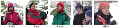
Hikers: Jodie, Millie, Pam, Pat, Randy
Weather: 20s and 30s, Overcast, Windy in the Ravine
Miles: 6.2
Elevation Gain: 2500 ft
Duration: 5.0 hrs
I led a group of people from work up into Tuckerman Ravine on Saturday. The conditions were vastly different than my trip the previous week.
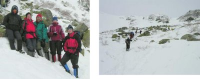
This trip was part of the BAE SYSTEMS Outdoor Adventure Club, of which I am currently President. Early in the week, it looked like nine people were coming, but two of them were planning on skiing and decided the conditions weren’t looking that good so they dropped out. Two other people didn’t show up, so that left us with a group of five. Four of us, Randy, Pam, Jodie, and I, drove up together from Hooksett. Millie was staying in North Conway anyway, so she met us at the trailhead. We had a fairly experienced group. Millie had even thru-hiked the AT last summer.
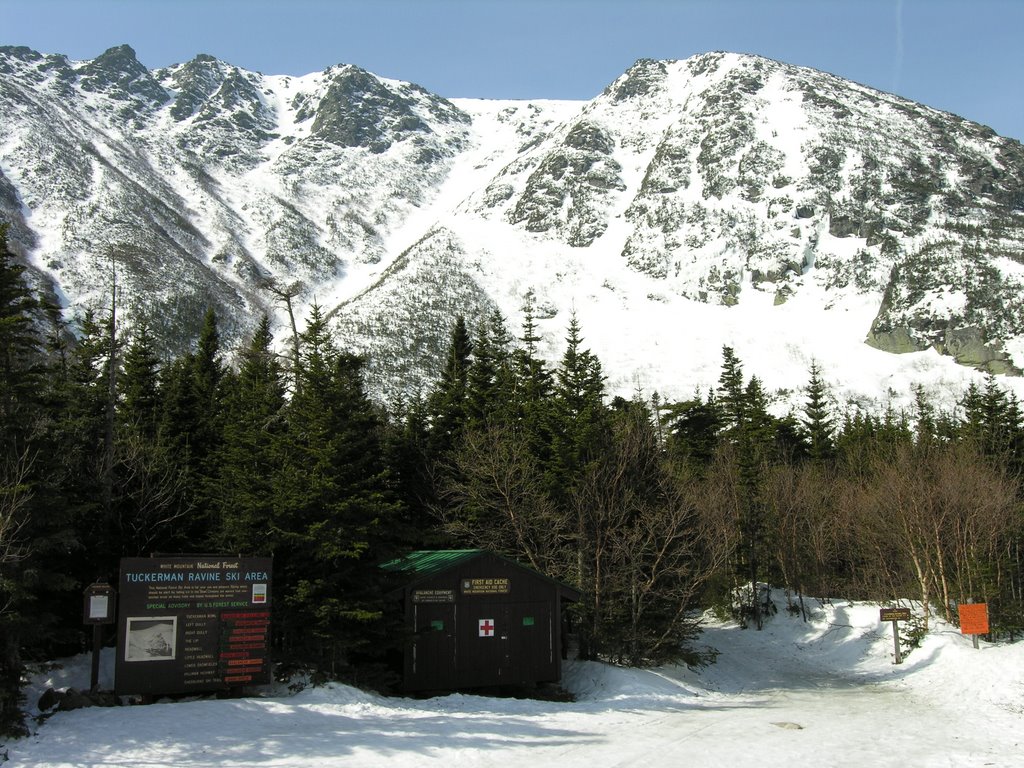
 We started hiking at 10:00am. The trail was covered in snow from top to bottom. There was only about an inch or two at the base, but progressively more as we climbed. The snow was well packed by all the hikers and the snowcats that go up the trail occasionally. It is 2.4 miles to Hermit Lake shelters and the caretaker’s cabin. Those 2.4 miles are a wide trail that climbs steadily, but never steeply. We had a good group, and we made it up to the cabin without any difficulties. We took a break at the cabin to layer up and grab some food. There were about thirty other people doing the same thing, most of whom had skis or a snowboard.
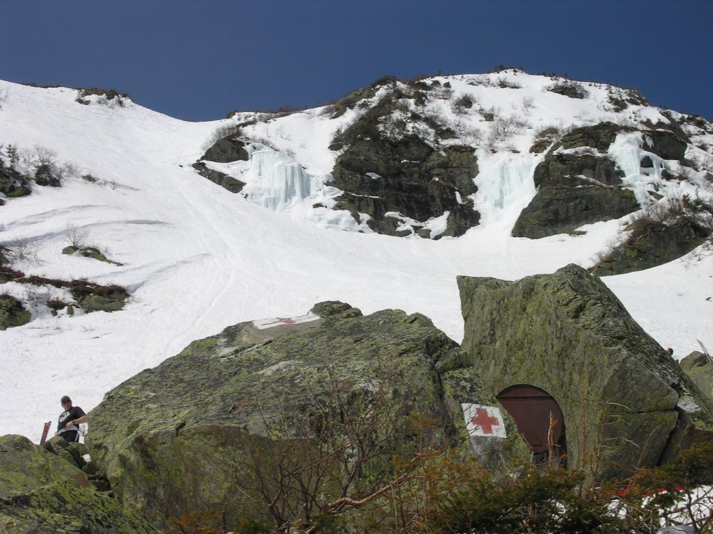
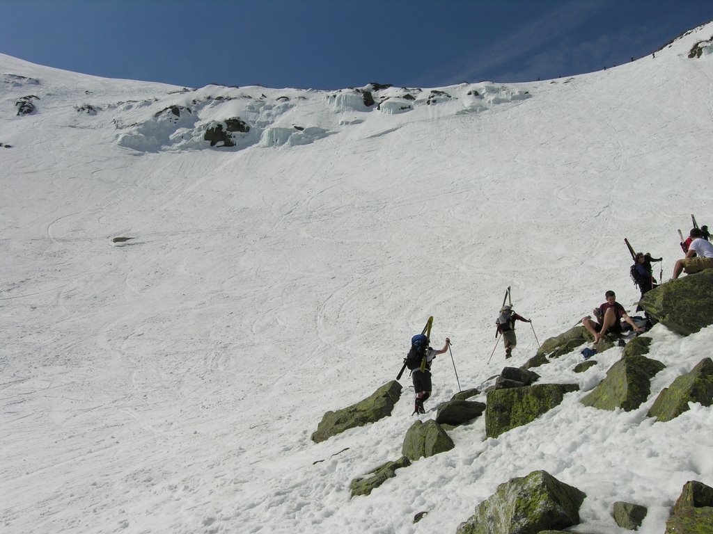
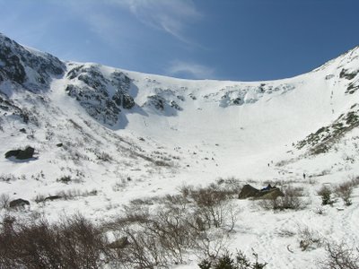
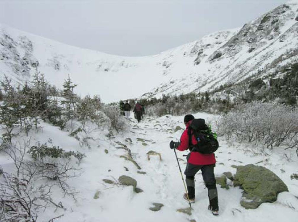 From the cabin, the trail narrows to a normal hiking trail and climbs a couple steep pitches. We got chilly during our break at the cabin, but the steep pitches warmed us up nicely. After those steep sections, the trail levels out on the floor of the ravine and it is only a short climb up lunch rocks. We took a fairly long break at lunch rocks admiring the steep walls of the ravine. A few people skied down while we were there, but most people were either hanging out at lunch rocks or climbing up the ravine with their skis. There was a bunch of fresh snow (18+ inches that week) that was covered with about an inch of crust. The crust was easy to kick solid steps through and provided a surprising amount of friction. I tried to slide a few times on purpose and didn’t have much luck.
 The climb down was fun and fairly uneventful. Pam tried her crampons for the first time, but they kept loosening up on her, so she gave up on them. The size adjustments on the crampons were changing after she put the crampons on. We think the extra piece that stuck out the back due to her relatively small feet (one size fits all crampons) was catching in the snow and changing the size adjustment. The trail wasn’t icy, so she was fine without them.
The descent from the cabin to the trailhead on the wide Tucks trail always seems to go by quickly. The trail allows two, three, or four hikers to walk next to each other easily, which facilitates good conversations. Jodie and Millie enjoy exchanging NOLS and AT stories. They seemed like old friends even though they had just met. And, of course, at some point the conversation turned to food. We decided to head down to Moat Mountain Smoke House and Brewing Co. in North Conway for some food. We reached the trailhead around 3:00pm, checked out the visitor center for a few minutes and then headed to North Conway for dinner.
We had a great hike! Tuckerman’s Ravine in the spring is sort of a cross between hiking and a circus because of all the people. It’s certainly not a hike for those seeking solitude, but it’s a fun hike with breathtaking views nonetheless.