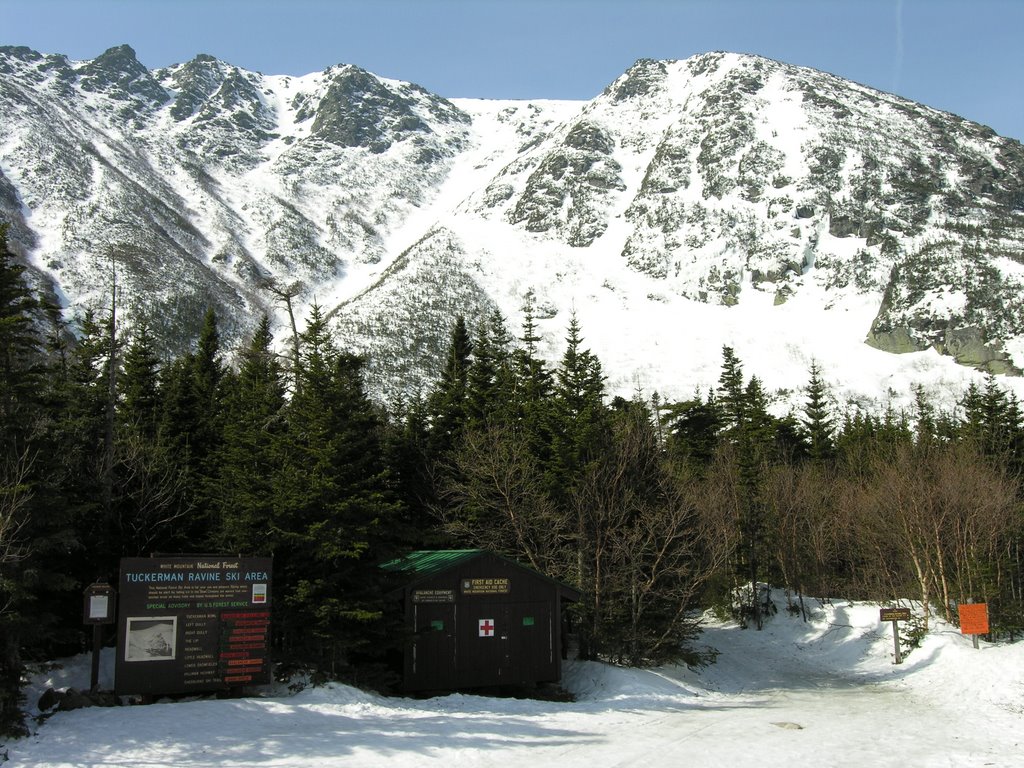
Temperatures broke the 70 degree mark in southern NH for the first time this year, and I decided to take the opportunity to head up to Tuckerman ravine. I’m so glad I did! It was absolutely gorgeous! I started hiking from Pinkham Notch around 8:30am and reached the caretaker’s cabin about an hour and ten minutes later. I took a break for a few minutes, grabbed a snack and some water, and was very glad I decided to hike in shorts and gaiters without the polypro.
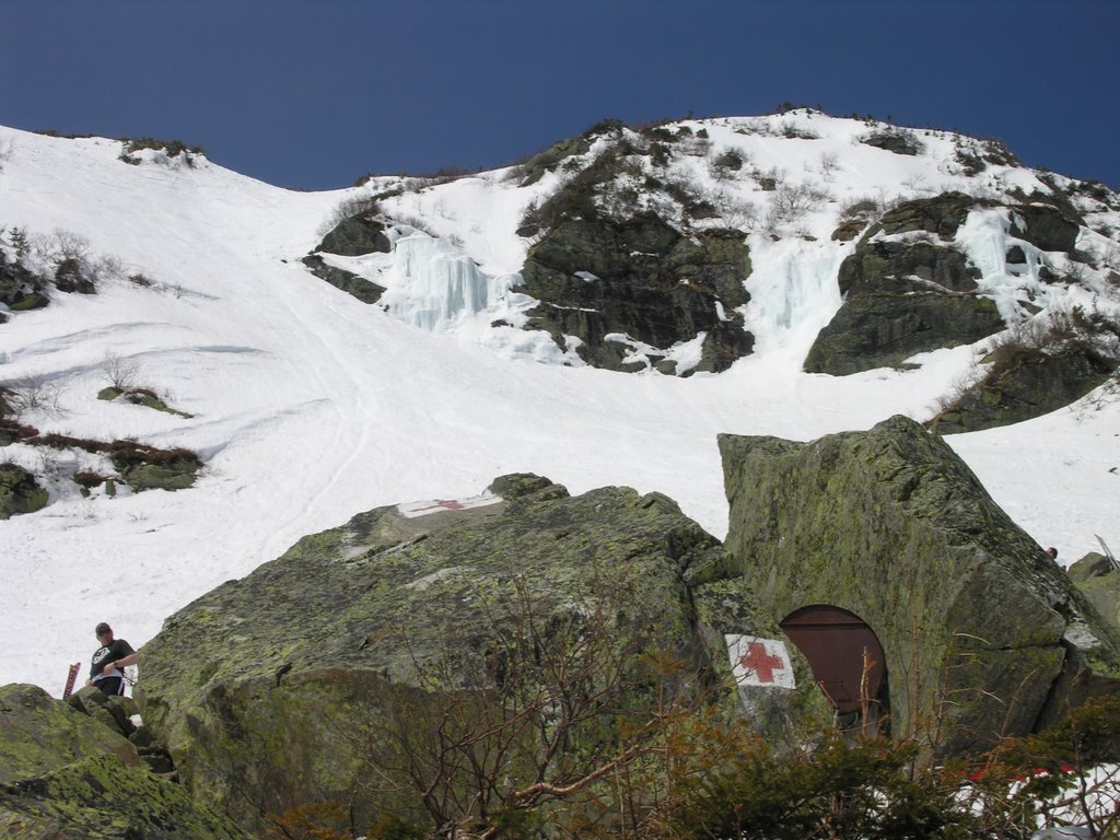
From the cabin, I headed towards Hillman’s Highway, the prominent gully on the south side of the ravine. I stopped at the base to get out my helmet and ice axe, and then began the long steady climb. I expected the climb to be long, which it definitely is, but I didn’t expect it to be quite as steep as it is. Particularly at the top, the gully exceeds 45 degrees. The gully seems to increase in steepness with every step. To compound the difficulty, the snow got more firm with every step. At the very top, I was basically on all fours kicking steps (very shallow steps) and scrambling up the slope. It’s pretty cool to all of a sudden pop out on flat terrain after climbing something so steep. I topped out at 11:15, took a break for awhile, and then hiked around the ravine to right gully. I contemplated going back down Hillman’s because I was feeling pretty wiped from the climb, but the steep, firm snow didn’t make the descent very appealing. I knew the snow would be softer on the other side of the ravine and I wanted to get into the bowl anyway, so Right Gully it was.
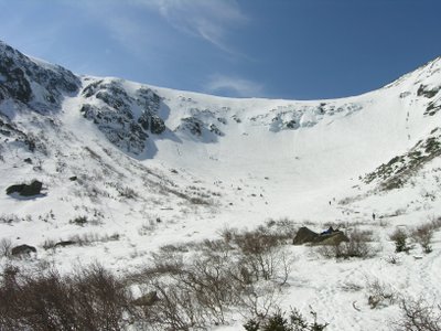
 It took very little time to hike around the ravine, and after my break I was feeling pretty strong again. I got to the point where the summer Tucks trail climbs out of the ravine and I wondered whether that would be an easy way down. I headed down that way for a little bit until I saw a few skiers and a line of people coming up. I realized I was heading straight for “The Lip”, which looked frighteningly steep, so I decided I better climb back up and look for Right Gully. It was hard to figure out exactly what part of the ravine I was above. I had descended Right Gully a couple years ago in May after climbing Lobster Claw Gully, but I remembered Right Gully wasn’t obvious from above. Soon I came upon a gully heading down into the ravine. I thought it was too soon for it to be right gully, but it looked big and not too steep. I decided to check it out. After testing the snow a little (nice and soft) and seeing where the gully went I decided to give it a go. Close to halfway down, I noticed I was next to a bunch of vertical ice. Now I knew I was definitely not in right gully, but in what I believe is called “The Sluice”. The last thing I needed
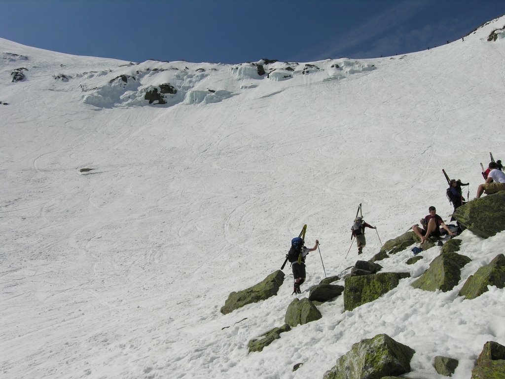 was for a big chunk of ice to break off in the warm sun, and if I continued straight down toward Lunch Rocks I would be in the ice fall zone for awhile. So, I traversed as quickly as possible below the ice towards Right Gully. Now safely out of the ice fall zone, I cruised down the bottom of Right Gully with a sitting glissade before finishing it of with a stylish standing glissade. I mingled around Lunch Rocks for awhile taking some pictures and watching the skiers, including one guy who jumped off one of the smaller waterfalls on the headwall and then tumbled down to the base of the ravine (to resounding cheers, of course).
The hike down from the ravine was more interesting than usual. Just after leaving Lunch Rocks, I passed a yellow lab a little bit in front of a hiker. The lab seemed to be trekking straight up the trail and not really paying attention to the guy, but I didn’t think too much about it. Then when I got down to the caretaker’s cabin, an older woman (70s?) asked if I had seen a dog. I told her I had, and then she said, “Well, why didn’t you tell it to come back here. That’s my dog.” I told her it was near some guy so I assumed it was his dog. She said her husband had gone up there to get the dog. I took a break for a little while and then continued down. Shortly, I caught sight of an older women (70?) hiking down the trail. She had hiking poles and was actively sliding with her trail running shoes at all the slippery spots. She was moving pretty well and it took me awhile to catch up with her. We then hiked down the rest of the trail together at a brisk pace. She has been retired for ten years and lives in Berlin, NH. Obviously, she is still very active and agile. It made me hope I’m in such good shape in 50 years.
It took about an hour to descend from Lunch Rocks to the trailhead. I was down around 2:00pm.
Distance: 6.5 miles
Elevation Gain: 3600 ft
Time: 5.5 hrs
No comments:
Post a Comment