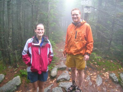
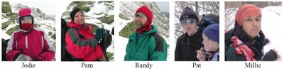
Wednesday, August 15, 2007

Quandary Peak (14,265 ft) Attempt CO

Tuesday 17 July 2007

Hikers: Pat
Weather: 50s-60s, clear
Miles: 5.6
Elevation Gain: 2,600 ft
Duration: 4.5 hrs

One of the things I was looking forward to on our Colorado vacation was climbing a 14er and if possible doing a class III route. After finishing our backpacking trip, Jodie was feeling like relaxing, but she was ok with me doing a 14er on my own. The West Ridge on Quandary seemed to be a relatively short route, but also class III, so I was excited to give it a try. It also worked out well because it’s near Breckenridge, which would be a sizeable town to entertain Jodie while I was hiking.

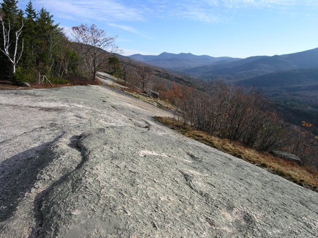
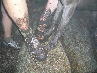
I ended up getting up really early and was at the trailhead at 6:00am. I followed the trail along Blue Lake and quickly reached a point where the trail appeared to fork. I didn’t think the trail climbed so quickly, so I took the branch closer to the lake. Apparently, that wasn’t the correct choice, as the trail became less defined. I reached a talus section near a stream coming down from the basin and decided to climb the talus. I connected back to the real trail after a short climb. The trail was pretty well defined through the basin and generally stayed close to the stream. At the head of the basin, I followed a faint trail up through the talus on the right of the stream and eventually climbed up the middle of the basin to the ridge.

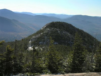
The West Ridge of Quandary begins with a traverse across the steep south side of the ridge. Soon, the route pops over to the north side and is a fairly easy climb along the ridge. Right before the summit, the ridge gets very sharp and there are a series of towers that need to be negotiated. I scrambled over and around a few towers before reaching one that didn’t appear to have an easy way around. I tried going to the left, the right, and straight over the tower, but they all looked pretty difficult. Since I was alone and quite far from the trailhead, with fairly difficult terrain between myself and the car, I decided to turn around rather than continuing on. I knew the summit was only a short distance away, but I also knew that it would be there another day, and I’d had fun so far.

The descent went fairly quickly, especially once I got off the ridge. I was back at the car by 10:30am. This was my first experience on a class III route, so I’m not sure if I just didn’t find the easiest route, or if class III is really harder than I thought.


Tuesday, July 24, 2007

Four Pass Loop - Maroon Bell/Snowmass Wilderness CO

Friday 13 July – 16 July 2007

Hikers: Pat, Jodie
Weather: 40s-70s, sunny, rain showers
Miles: 28
Elevation Gain: 2,920 ft
Duration: 3 days

Jodie and I did the Four Pass Loop outside of Aspen, CO. It is a very beautiful route. We spent most of the first day getting ready and walking around Aspen. In the evening, we backpacked in 1.5 miles to Crater Lake for our first night. The next morning we hiked up and over Buckskin Pass, and then down to Snowmass Lake. All the passes on the route are fairly similar in that you hike up to them at a moderate grade and then the last bit of trail before the pass is a steep series of switchbacks that, combined with the altitude ~12,400 ft, is guaranteed to take your breath away.

Looking back from Buckskin Pass

Snowmass Lake and Trail Rider Pass

Snowmass Lake is visible from Buckskin pass, and the hike down to the lake is nice. There is a little bit of climbing just before the lake that can be hard at the end of the day. There are many established campsites at Snowmass Lake – and many mosquitoes. We brought our bug head nets so the bugs didn’t bother us too much. We hung out in the tent most of the time after dinner anyway. The bugs weren’t quite as bad next to the lake, so we did spend some time there too.

View toward Fravert Basin from Trail Rider Pass

On our second day, we climbed up and over Trail Rider Pass, which has a great view down into Fravert Basin. The descent down into Fravert Basin is long and steep at times. We made good time and were feeling strong, so we continued high up into Fravert Basin, passing a nice waterfall and several established campsites shortly thereafter. As the trail began to turn farther away from the stream, we decided we had better find a campsite before we got too high up. We found a fairly decent, not particularly flat, site that was suitable for the night. The bugs were pretty bad at this campsite as well, but not as bad as at Snowmass Lake.

The third day was our final day. We climbed up and over Frigid Air Pass, which has amazing views of the curving maroon ridge that forms the side of Fravert Basin, as well as views towards the mountains outside Crested Butte. The route descends slightly from Frigid Air Pass and then makes a downward traverse towards West Maroon Pass. The wildflowers are spectacular at all the passes, but this section has particularly tall wildflowers. Thankfully, not a lot of elevation is lost before the climb up to West Maroon Pass Begins. West Maroon Pass is a narrow rocky pass that was by far the most popular of the ones we visited. We encountered many people who were doing day hikes from Aspen or Crested Butte, or in some cases people who were doing a one-way hike from Aspen to Crested Butte.

View towards Crested Butte from Below West Maroon Pass

The descent down from West Maroon Pass to Maroon Lake went smooth, though it did seem to drag on towards the end when Jodie and I were both ready to be done. We took showers at the Aspen Rec Center before heading back into Aspen for dinner.

Back at the Maroon Bell Trailhead

Mt. Sopris (12,953ft) CO

Wednesday 11 July 2007

Hikers: Pat, Jodie
Weather: 70s, sunny
Miles: 12.0
Elevation Gain: 4300 ft
Duration: 8 hrs


Mt. Sopris rises high above the town of Carbondale and is easily seen from Glenwood Springs. It has distinctive twin summits, about a mile apart, but with the same elevation. Here is a 1903 photo of Sopris above Carbondale. Jodie and I were originally thinking of attempting a 14er, but after seeing Mt. Sopris we decided it was definitely a worthwhile objective. As an added bonus, it is only about 45 minutes from downtown Glenwood Springs.

There is a trail that climbs into Thomas Lakes, on the north side of Sopris, and then climbs up the east ridge. The trail into Thomas Lakes, about 3.5 miles, is well defined and a fairly easy. It goes through a section of meadow where the wildflowers were in full bloom. After Thomas Lakes, the trail climbs several switchbacks to get onto the lower part of the ridge. It then winds its way up the ridge, becoming rougher and steeper until finally reaching the summit ridgecrest. The last portion before the ridgecrest is a steep talus section where the trail becomes faint. There is still about a mile of traversing and climbing to reach the eastern summit.


Hanging Lake - Glenwood Canyon

Tuesday 10 July

Hikers: Pat, Jodie
Weather: 70-80, sunny
Miles: 3.0
Elevation Gain: 1000 ft
Duration: 2 hr

Hanging Lake is a must-do hike in the Glenwood Springs area. It’s in Glenwood Canyon and hikes a short way up into a side canyon. The heavily used trail leads to a beautiful lake where waterfalls cascade into the lake at the far end. There is no swimming in the lake (or dogs allowed on the trail) to protect the travertine that is forming around the lake. The water in the lake is a clear greenish blue color.


A short ways above Hanging Lake is another interesting sight called Spouting Rock, where the water comes spouting out of the middle of a cliff.

Arches National Park Moab, Utah

Monday 9 July 2007

Moab is a great place to visit. The landscape is so unique and beautiful, with all the canyons, towers, and arches. I visited Moab a few years ago and realizing that its only about 3 hours from Glenwood Springs, I talked Jodie into going for a day trip. Of course last time I went, it was November and pretty cool. It ended up being 104 F when we went this time.

We drove into Moab via route 128. On the way we stopped at the Fischer Towers to walk around a little bit. There is a nice view towards Castleton Tower from the area. We also saw a neat rock formation that looks like faces in the rock.


Once in Moab, we headed straight to Arches National Park and Delicate Arch. Delicate Arch is the most famous of the arches, but it's also the only one with a substantial hike to reach a good viewpoint. We knew it was going to get hot, so we wanted to get the hiking out of the way as early as possible. Even around 10:00 am it was almost a hundred degrees. The hike is about 1.5 miles to Delicate Arch. It's not the easiest 1.5 miles, as the trail does climb up in elevation, but it's not very strenuous. We hung out at the top for a only a short time, taking a couple photos before descending. On the way back we took a slight detour to see Ute Rock, which is a petroglyph well worth the visit.


We also drove around to the Windows area of the park and did a short loop hike through some of the arches there. We also stopped at balance rock, but didn't go to the far end of the park because it was uncomfortably hot and we needed some food.

We got some pizza at Zax's in downtown Moab, and then walked around town for awhile. Some of my favorite stops are at the Tom Till Gallery, Pagan Mountaineering, and the local bookstore (where they have signed Edward Abbey books).

One of my other favorite things about Moab is the famous Slickrock Trail. Unfortunately, we didn't have time to rent some bikes and ride the trail, but we did drive up there just so I could show it to Jodie.

Monday, July 23, 2007

Trail Maintenance Backpacking Trip - Isolation Trail (West)

Friday June 29 – Saturday June 30, 2007

Hikers: Pat, Jodie, Lincoln, Luna
Weather: 70s, sunny
Miles: 23
Elevation Gain: 2,798 ft
Duration: 2 days

Jodie and I wanted to do a couple days of backpacking in preparation for our upcoming vacation to Colorado. I also wanted to do some trail maintenance on my trail, so we decided to do a backpacking trip in conjunction with trail maintenance. The plan was to hike in and camp near the junction of the Dry River Trail and the Isolation Trail on Friday. After setting up camp, we would hike up the Isolation Trail to the Davis Path and do a couple hours of trail work. Saturday, we planned to do a day hike up either the Dry River Trail or the Eisenhower Trail and potentially loop over to Mt. Isolation. Sunday would be a couple hours of trail maintenance before hiking out. . . that was the plan anyway.

Things ended up going a little different. Friday went pretty much according to plan, though Lincoln did get some porcupine quills in his face during our trail maintenance. Jodie and I spent most of our maintenance time brushing the trail corridor, which is quite over grown in many locations, though I did clean drainages as well. It was a big help to have a second pair of hands. Even so, there is a lot more work to be done.

Saturday didn’t go according to plan. We woke up and go prepared for our day hike, but noticed it was quite windy. We weren’t sure how windy it would be above treeline, and we weren’t sure how the dogs would react if it was really windy, so we decided to do Mt. Isolation first. The hike to Mt. Isolation went well, and the views were nice from the summit. We decided to continue on the Davis Path towards Mt. Davis, and about half way there Jodie twisted her ankle. The same ankle she broke back in November. Needless to say, the ankle has yet to regain full strength. We were about 8 miles from the nearest road at this point, but luckily it was good enough to walk on with some pain.

We made a rather slow descent back to the campsite and decided to hike out that evening. It wasn’t until about 7:30pm that we reached the car. We started hiking around 9:00am, and covered about 13 miles that day (about 8 with Jodie’s bad ankle).


Lincoln and Luna in the Tent

Lincoln and Luna at Isolation's summit

Lincoln, Luna, and Jodie at the summit

Also see Jodie's Backpacking!! post on The Weimaraner Chronicles.

The Horn (3,905 ft)

Friday June 8, 2007

Hikers: Pat, Jodie, Lincoln, Luna

Miles: 10.6

Elevation Gain: 2,265 ft

Duration: 6 hrs


Jodie and I took the Friday before Memorial Day weekend off to go do a hike. Since we were going up to camp after the hike, we decided to do one of the hikes way up north – north of Berlin. I remembered doing a nice loop hike up the Unknown Pond Trail, over The Horn, The Bulge, and Mt. Cabot via the Kilkenny Ridge Trail, and back down the Bunnell Notch Trail. The loop is about 15 miles, which is pretty long, but I figured we’d have all day and it would be nice to get out. We got a late start, somewhat on purpose, because we wanted to sleep in, and didn’t start hiking until 11:30am. It was one of the first hot muggy days of the year, which made the hiking more difficult that usual. We made the hot hike up to Unknown Pond and had already drank more than half of our water.


We continued on, and climbed up to the summit of The Horn. The Horn is a nice rocky summit with some great views of the north country. The rockiness of the summit was a little difficult for the dogs; there were a couple big steps and scrambles. They did them without too much difficulty, but it makes me a little nervous when they jump down such big drops.

We paused to enjoy the views and some food. We discussed the hike ahead. We still had to climb up and over The Bulge and then up and over Cabot. The route ahead looked long and fairly difficult. We decided that we had had enough of a hike for the day and retraced our route back to Unknown Pond and the car. The last portion of the Unknown Pond Trail seemed to go no forever. Both Jodie’s legs and my own were tired from the hike, and not particularly used to all the effort – we don’t hike as much as we used to, nor run as much. Once at the car, the dogs enjoyed their dinner and promptly passed out in the back seat of the car. I envy them sometimes – play hard, and when you’re done, you’re done, time for sleep.


Jodie also posted some pictures from this trip in her post "For your viewing pleasure..." on The Weimaraner Chronicles.


Isolation Trail (West - Dry River to Davis Path) Maintenance Trip

Friday May 18, 2007

Hikers: Pat, Lincoln, Luna
Weather: 40s, cloudy, occasional rain
Miles: 10.0
Elevation Gain: 1400ft
Duration: 8 hrs


I took the dogs for my first trail maintenance session of the year. I was originally planning on doing an overnight so that I could get more maintenance time on the trail, but it was a relatively cold and rainy weekend and Jodie couldn’t come, so I ultimately decided on a day hike. It takes about 2.5 hours to drive to the trailhead, pick up the tools from the Crawford Cache, and get packed up for the trail. It then takes another 2 hours to hike the 4.9 miles along the Dry River Trail to the beginning of my section.


On the way to my trail, I fell during a river crossing when a rock that I lunged to rolled over. I fell in the river and hit my head on a log near the riverbank. I hit my head pretty hard, but fortunately not too hard. I took a minute to collect myself, and then decided to continue on with my hike. I was about 4 miles from the trailhead on a lightly used trail on a rainy cold Friday in May. I was certainly lucky that my fall wasn’t worst; help would have been a long way off. I am pretty careful when I hike, especially when I’m alone. I had actually crossed the stream twice already, but was trying to find a location that the dogs were comfortable with. The rock I stepped on was about 2 feet in diameter, and rocks of that size are typically stable. The rock was a little outside a comfortable stepping range, so I was forced to jump to it. I jumped out with my left foot, intending to immediately to step to shore with my right leg. As soon as my left foot hit the rock, it rolled to the left, giving me no time to recover. The fall was so quick, there wasn’t much I could do. I took the force on the fall along my left side, with my left forearm, elbow, and head taking the brunt of the blow. I immediately scrambled out of the ice-cold water onto the bank and sat down on a log to collect myself. A wave of pain came through my left arm and head, but subsided fairly quickly. My arm actually hurt the most. After a few moments, I decided I was ok and continued with the hike. All future river crossings on this trip, I just walked through the water. Better wet shoes than a broken head.


The trail maintenance went pretty well. I planned on focusing on clearing the drainages, and then brushing out with the time I had left. I started working on drainages as I came to them, instead of hiking the whole trail first. I did some good work, many of the drainages hadn’t been cleared in a long time, but didn’t make it very far up the trail. I spend a long time reconstructing a short section of trail through a landslide area. It took some extensive side-hilling work to establish the trail.


My trail needs some more work. Obviously, I didn’t even cover the whole length of the trail. I’m hoping to go back next month and do an overnight. I’m also hoping Jodie will come. Another person would be a big help.


Kearsarge North (3,268 ft) via Mount Kearsarge North Trail

Saturday January 27, 2007

Hikers: Pat, Millie, Stacey
Weather: zeros-teens, clear/cloudy, light snow
Miles: 6.2
Elevation Gain: 2600 ft
Duration: 5 hrs

It was one of the coldest days of the year so far on Friday. Highs in southern NH reached the mid teens with below zero temperatures at night. Saturday morning was very cold, below zero, but it warmed into the twenties during the day. The temperature display on my car said 5 degrees F when we reached the trailhead on Hurricane Mtn Rd at 9:30am. When we returned around 2:30, it said 19 degrees F. It was definitely cold, but the hike really wasn't bad because there was no wind.

I drove up with Stacey, a BAE employee, and met Millie at the trailhead. Stacey was a beginner winter hiker, though she did quite well. I think most beginners, Stacey included, wear too many clothes when winter hiking, even when you try to tell them to take off a layer. Temperature regulation is definitely one of the hardest things about winter hiking. You want to stay dry, so you don't want to have too many layers, but they you tend to get cold quickly when you stop.

We had a good hike and enjoyed hanging out in the glass enclosed lookout tower on the top. It was cloudy with some snow showers, so the views weren't great, but they were still good.

This was my first time hiking North Kearsarge. It was a good hike. Nice views, a pretty good climb (2600ft) and relatively short (3miles). I'd definitely do it again.

Thursday, December 28, 2006

Carr Mountain (3,453 ft) and Three Ponds/Kineo Trail Loop

Wednesday December 27, 2006

Hikers: Pat, Lincoln, Luna
Weather: high 20s - low 30s, cloudy, light snow
Miles: 11.1
Elevation Gain: 2143 ft
Duration: 4.5 hrs

Carr Mountain is near Stinson Lake in Rumney, NH. I wanted to take the dogs hiking at least once during the holiday break, and I decided on Carr Mtn because it is a relatively short drive - a little over an hour. I first heard of Carr Mtn a little while ago when I stumbled upon a list of peaks in New Hampshire that have good views. The list is called 52 With-A-View, and consists of peaks below 4,000 feet in elevation.

I was somewhat surprised to see snow on the ground at the trailhead since there wasn't any snow when I hiked Mt. Tremont a couple weeks ago and the weather hasn't been very cold since. Apparently, the mountains did get some snow. There was about an inch of crusty snow for most of the hike with slightly more at the summit.

The summit is 3 miles from the trailhead via the Carr Mountain Trail. The trail was fairly wet and muddy. So much so, that at one point I was starting to wonder if I'd taken a wrong turn and was following a streambed instead of the trail. The trail climbs pretty steadily but is never steep. The summit has remnants of a fire tower and some open rock. It was clouded in when I was up there, so I didn't get to observe any of the supposedly good views.

The descent down the trail went quickly and I was back at the Three Ponds Trail at noon, so I decided to hike that 5 mile loop before heading back to the car. The trail is wet near the ponds, but nice overall. There is a shelter near one of the ponds, though I didn't go and look at it.

Mt. Tremont (3,371 ft) NH

Saturday December 16, 2006

Hikers: Pat, Lincoln, Luna
Weather: 40s, cloudy
Miles: 5.6
Elevation Gain: 2600 ft
Duration: 3.5 hrs

I took the dogs up Mt. Tremont today. It was the first time I’d been hiking in a couple months; it was nice to get out. Jodie’s ankle is still healing (she broke it running with the dogs at Tower Hill), so she wasn’t able to come.

Mt. Tremont is in Crawford Notch, though at the southern end. The trail climbs moderately for the most part, and never that steeply. After crossing the Stony Brook (1.5 miles?) it climbs increasingly steep until reaching the summit. The summit has some open ledge with great views toward the Kancamangus Hwy valley, Passacaonaway, the Tripyramids, Carrigain, etc. The view down to Sawyer Pond was very interesting. The area looks vast and wilderness-like.

Despite it being mid December, there was basically no snow on the entire trail. Near the top there was a very small cover in many places, but not everywhere. The trail was almost completely bare except for some special areas. I can’t recall a December with so little snow in the mountains.

This was a fun hike, and a little more challenging than I expected. I’d like to go back on a clear day to take in the full view.


Wednesday, October 25, 2006

Welch (2605 ft) and Dickey (2734 ft), NH

Sunday October 22, 2006

Hikers: Pat, Lincoln, Luna
Weather: 30s and 40s, sunny
Miles: 4.4
Elevation Gain: 1800 ft
Duration: 2.5 hrs


Jodie is out in NY on travel this weekend, so I took the dogs for a hike by myself. I worked Friday and Saturday and I had a lot of homework to do on Sunday, so I decided to go for a short hike. Welch and Dickey are a little over an hour from the house. I had heard about them being nice open peaks with a lot of views, and I’ve thought about hiking them for awhile. It turned out to be a great day for a hike.

It was a little cold when I started hiking at 8:30 am (34ºF according to my car). The dogs didn’t seem to mind though. They were very excited as usual. There was some ice on sections of the ledges that made going a little slow, but the views were great. There was even a little fresh snow to cap the surrounding peaks.

Wednesday, September 27, 2006

North and South Hancock

Sunday September 24, 2006

Hikers: Corey, Jodie, Pat, Lincoln, Luna
Weather: 50s, cloudy, rain, t-storms
Miles: 9.8
Elevation Gain: 2650 ft
Duration: 5.5 hrs

Corey is visiting New England for about a month before he heads back to Mammoth, CA for another winter on ski patrol. We decided to go for a hike despite the weather forecast, which called for rain. When we arrived at the trailhead, there were a couple small breaks in the clouds and it didn’t look that bad, so we were optimistic.

The first part of the route up the Hancocks uses the Hancock Notch Trail and the Cedar Brook Trail. Both trails are relatively flat and easy. There are several stream crossings, but the water was pretty low, so they weren’t much trouble. The easy terrain let us enjoy the colors of the trees, as many of them have already turned bright reds, yellows, and oranges.

It started to rain lightly as we began the steep ascent up to North Hancock. It continued to rain while we were up on the ridge, so we didn’t see any views. The descent from South Hancock was very steep as well, and it began to pour just as we started down. We were somewhat happy about the heavy rain though because Lincoln had rolled in some poop at the summit and we hoped the rain would wash it away.

As we neared the road, the rain stopped an the sky began to clear. By the time we had driven back to the town of Lincoln, the sky was bright blue. Hiking in the rain really isn’t that bad though. We had a great time. It was nice to see Corey again.

Tuesday, September 12, 2006

Trail Maintenance on Isolation (West) Trail

Sunday September 10, 2006

Hikers: Pat, Lincoln, Luna
Weather: 40s and 50s, Sunny
Miles: 15.0
Elevation Gain: 2950 ft
Duration: 9.0 hrs

This was my first maintenance trip to my newly adopted trail, the 2.5-mile section of the Isolation Trail from the Davis Path to the Dry River Trail. It also turned out to be the first hike with our new dogs Lincoln, and Luna.

I had never hiked the section of trail that I adopted, but I had seen the end of the trail on the Davis Path and it looked very overgrown and hardly passable. One of the reasons I decided to adopt the trail was that I knew it needed work, and I felt it would be very rewarding to make a big difference. My goal on this first trip was largely to see what I was up against so I only brought a saw and some loppers. With the saw, I hoped to clear out all the blow downs and make the trail passable, and with the loppers, I wanted to cut back the overgrowth as much as possible.

In some ways, the trail was in better shape than I expected. I didn’t come across any major blowdowns; it appears the Forrest Service was able to send a trail crew through this year. The trail was still heavily overgrown. By the time I reached the Davis Path, I was absolutely soaked from constantly pushing through dew soaked branches. I spent three and a half hours clipping back branches that were extending over the trail, but I doubt I even covered a half-mile of trail. Obviously, there is a lot of brushing work remaining, but otherwise the trail is in decent shape.

It took me about 2 hours to drive to the trailhead from home, 2 hrs to hike the 5 miles of the Dry River Trail to the beginning of my trail, and 1 hour and 15 minutes to hike the 2.5 miles up my section of the Isolation Trail.

It’s a nice hike, and the dogs did very well, despite getting bored during my trailwork.

Tuesday, August 15, 2006

North Moat (3,196 ft) via Red Ledge Trail with BAE Outdoor Club

Saturday August 12, 2006

Hikers: Jon, Jacques, Mary, Mary, Millie, Gig, and Pat
Weather: 60s, Sunny
Distance: ~8mi
Elevation Gain: 2200 ft
Duration: 6 hrs 30 min

We had a good turn out for our trip up the Red Ledge Trail over North Moat and down the Moat Mtn Trail. The loop is 10 miles with a decent amount of elevation gain. The first couple of miles were very flat and easy to travel. There were a couple stream crossings that might be difficult at high water, but not today.

Soon after the last stream crossing, the Red Ledge Trail starts to climb abruptly up the ridge. The ridge has a lot of ledge with lots of open areas and nice views. The ledge is not particularly steep, but there are several places that require large steps. Mary’s dog Luke had a difficult time on these large steps. Mary had to carry him over many of them and the dog significantly slowed our pace. The views and the brilliant weather made it very easy to enjoy a slower pace and many rest breaks. We had a great group, so the conversation came easily as well. I particularly enjoyed talking to Millie, who is a very avid hiker. She has thru-hiked the AT and has thru-hiked the Long Trail each of the last 5 years. She went on the Tuckerman Ravine hike earlier this year, but it was the first time I met her husband Gig. He seemed very nice as well.

As we climbed higher up the ridge, it became more and more open. The rock is similar to the open peaks of Acadia. Luke continued to struggle, so we ultimately decided that it was best for Mary, Mary, Luke, and I to head down. Jacques had taken off ahead of us in anticipation that he’d be slower than the rest of the group, however we never did catch up to him. Jon and Jacques had come in a separate car, and so had Millie and Gig, so they could easily continue on the loop without any logistical issues of trying to meet up again. So that is what we did. Jon, Millie, and Gig caught up with Jacques at the Moat Mtn Trail junction, and Luke did much better once he was pointed down hill. He did very well for a 13 year old golden retriever, and would have been fine if it wasn’t for the big steps.

After the hike, Mary, Mary, and I met Millie and Gig at Flatbread’s for a quick drink and appetizer before heading home. Mary had borrowed Gig’s poles, so it was a good excuse to get back together.

Saco River Kayaking – Fryeburg Rt 5 Bridge to 302 Bridge

Saturday August 5, 2006

Kayakers: Kim, Ethan, Kristin, Dustin, Jodie and Pat
Weather: 80s, Sunny
Distance: ~7 mi
Duration: 5.5 hrs

At Kim and Ethan’s wedding, we sat at a table with Kristin and Dustin and they mentioned that they were planning on going kayaking with Kim and Ethan the following weekend. Jodie and I didn’t have any other plans, so we were excited when they invited us along.

Dustin organized everything. He reserved the kayaks from Saco Valley Canoe and Kayak, and picked the meeting place and time. We rented two double sit-on-top kayaks, one single sit-on-top kayak, and another single regular kayak. We met at Saco Valley Canoe at 9:00am and they dropped us off at the Route 5 bridge in Fryeburg and told us they’d pick us up at the 302 bridge at 2:30.

We mostly just floated down the river with some short bursts of paddling, primarily to avoid trees. We did paddle near the end of the trip because we were concerned we’d be late. As it turned out, we reached the take-out point right at 2:30.

We had a lot of fun chatting as we went down the river. It was nice to catch up with Kim and Ethan, and Kristin and Dustin were very nice people that we enjoyed getting to know. We stopped at a beach around 11:00 and had some snacks. We also stopped to swim at another beach later on. There was a constant flow of canoes down the river, and most of the beaches were densely packed with tents and people. Some of the people were quite rowdy and unpleasant. It seems like the river is more heavily used each year. We still had a great time, and probably going earlier or later in the year would avoid a lot of the crowds.

After the kayaking, we spent a little bit of time in North Conway before heading back to Ethan’s parent’s house in Madison, NH. His parents have a great house, and we enjoyed some hamburgers and hotdogs. Unfortunately, Jodie and I had to get back to take care of Sampson. We had a very fun day!

Monday, July 17, 2006

Bird Ridge – Anchorage, AK

Thursday July 6, 2006

Hikers: Jodie and Pat
Weather: 50-60s, In the clouds
Miles: 5+
Elevation Gain: 3200 ft
Duration: 3.5 hrs

We had to drive south from Anchorage, back towards Whittier, to reach the Bird Ridge trailhead, but it was a short drive. We started hiking up the trail around 10am. The trail begins climbing in earnest and maintains a steady steep grade with minor fluctuations. The trail is a dirt path with some short scree-like sections. I find this type of path much easier than the rocky paths of NH (where the size of your next step is often determined for you by the size of the rock in front of you). I shifted into low gear, taking small relatively quick steps, and ascended the trail. I wasn’t climbing particularly fast, but it felt good and I felt like I could have kept going all day. Jodie was doing well too and seemed to be enjoying the hike much more than in Sitka. Though it was cloudy, we were still getting breaks and could see a little bit. There were many flowers all around the trail. The trail was mostly through grasses and sparse, short trees; it was an alpine trail.

Soon it became quite obvious things were not going to clear as we got higher; it was getting worse. Jodie’s legs started to get tired and she wanted to head down. I convinced her to drop her pack and continue for a while with out it. I really wanted to get to the top of the ridge, partly to say we climbed the whole thing, partly so I’d know what elevation we reached, and partly so we could see what the ridge was like when it leveled off. I wondered how narrow and rocky or grassy the ridge was going to be.

We continued for about fifteen minutes without Jodie’s pack. We made it to a relatively large level point, and I hoped it was the top, but after I ran a short ways ahead, I saw the ridge climbing steeply again. At the base of this next climbing portion was an 8 to 10 ft snowdrift. I went back and told Jodie about the snowdrift and we decided to make that our turn around point.

The hike down went quickly. It was steep and tricky in a few places because of the loose gravel on the trail, but not too difficult.

Though this was a relatively short hike, it had more elevation gain than most of the trails in the White Mountains. The Alaskan Mountains rise straight from the ocean.

Quote of the Day
“Lets go to Anchorage and show them the New Hampshire way! We’ll drive with courtesy and shop like there’s no sales tax!” – Pat driving back from the hike

Sea Kayaking and Portage Glacier Trail – Whittier, AK

Wednesday July 5, 2006

Paddlers: Jodie, Pat, Kelly(guide), another couple, and a family of three
Weather: 60ºF, Cloudy with breaks of sun

We had called from the ship and booked ourselves on the 1:00pm Alaska Sea Kayakers tour, so we had a bunch of time to use before the tour. We decided to hike out of town towards the tunnel and then up the Portage Glacier Trail. It was a very nice little hike. We climbed up to a small overlook where we could see across the valley to the glacier. We enjoyed the nice view for a little while and saw a couple marmots. We returned to town and had lunch at the Whittier Inn.

After lunch, we hung out at the kayak place for a while before our tour started. We found out there was going to be another couple and a family of three on the tour, making an odd number. The guide asked us, since we had previous experience, if one of us would mind going in a single kayak. We preferred to go together, but since no one else was willing, we’d split up. The family of three had a young 10-year-old girl. The girl wanted to go with her mom, but the guide suggested she go with her dad to make things a little more even in paddling strength. Despite several suggestions from the guide, the family decided to have the girl and mom in one kayak and the dad go with Jodie. I was in the single kayak. As the guide expected, the mother and girl went at a very slow pace, the girl didn’t paddle for very long. Jodie said it wouldn’t have made much difference if the dad was with the girl because he was “dead weight” in her boat, but I think he would have learned how to paddle if he needed to.

The kayak trip was straightforward; just around the end of the inlet, but it was still fun. I enjoyed using the single kayak. We saw about 5,000 nesting black-legged Kittiwakes (seagulls) at one location in the inlet as well as a pair of oystercatchers (more birds). The water was murky with glacial silt and about 40 degrees F, which is quite different from the clear, warm waters of Ketchikan. I think the tour covered less distance than normal because of the family, but we were on the water a long time. It was about 4:45 when we got back on land.

Gavan Hill - Sitka, AK

Monday July 3, 2006

Hikers: Jodie and Pat
Weather: 60s, Overcast, in the clouds, Undercast
Miles: 6
Elevation Gain: 2500 ft
Duration: 3.5 hrs

Jodie and I decided to hike up Gavan Hill because it is an easy walk from town; the trial starts at the end of Baranoff Rd. The trail reaches the summit of Gavan Hill at 2505 ft in about 3 miles. We were surprised to find the majority of the trail to have wooded boardwalks and wooded steps, even the higher portions. The trail climbs steeply and steadily up the hillside via numerous switchbacks. Jodie was tired from the early wake up at 6:30 and just wasn’t feeling the need to hike up this mountain. The skies were overcast and we were hiking through the clouds. I encouraged her to keep going and enticed her with the possibility of hiking above the cloud level. But she didn’t buy it, at home it is very rare to hike above the clouds, and she decided to turn back, though she agreed to let me continue for a little while.

Shortly after Jodie headed down, I reached the top of the ridge and could see the clouds thinning. I was hopeful that the ridge would climb high enough to break above the clouds and it did. Soon, I was above a sea of whiteness standing on a small mountain island in bright sunshine. It was the strangest feeling. For a while I couldn’t figure out what the feeling was, but then I realized that I felt like I was flying. I was on a narrow ridge above the clouds experiencing what most people only experience in flight. The stillness of the air was amazing; not a breath of wind. There were swarms of bugs; thick clouds of bugs, but luckily they weren’t biting. There were steep, pointy mountains all around. It was the most amazing experience! I was so glad I had decided to keep going after Jodie turned around, but I was sad she didn’t get to experience it too.

Denver Glacier Trail - Skagway, AK

Sunday July 2, 2006

Hikers: Jodie, Pat, three guides, and 12 others from the ship
Weather: 60-70, Sunny
Miles: ~5
Elevation Gain: 500 ft
Duration: ~2.5 hrs

Jodie and I signed up for the “Hike and Rail” shore excursion offered through the ship. It was $114 per person. The “Hike and Rail” sounded really good. We were expecting to take the train up to White Pass, do some hiking, and then take the train back to town. Unfortunately, it wasn’t what we expected. The excursion only took the train six miles to the Denver Glacier Trail. We had to catch the same train back to town, so we didn’t have a lot of time to hike.

Needless to say, Jodie and I were pretty bummed after getting off the ship and finding out the excursion wasn’t what we expected and several of the people going on the hike were very out of shape. Particularly after the fun we had with Corey in Juneau, it looked like this hike was going to be a big let down. Fortunately though, it did turn out pretty well. There were three guides for our group of 14 cruise ship people, and the first guide set a very quick pace. His job seemed to be to separate the faster hikers from the slow ones. That was nice because it allowed Jodie and I and four others to get ahead and see some more of the trail. We made it all the way to a waterfall lookout, which is about .75 miles farther than their typical turn around spot. The guide said the trail continued to climb for a little while after the waterfall and then leveled out near the Denver Glacier. It would have been cool to see the glacier but we had to be back to catch the train at 11:30.

The hike was nice; I would have liked to see more, but hiking with a guide has some advantages. The guides pointed out several plants and facts about the area. The trail was very alive. The dirt underfoot is soft, dark, and full of nutrients. There is moss on almost everything, new trees growing directly out of the fallen trees, and devil’s club with its huge leaves. Hiking through such an area makes you feel more alive.

Mendenhall Glacier - Juneau, AK

Saturday July 1, 2006

Mountaineers: Bria, Kent, Floyd, Laura, Corey, Jodie, and Pat
Weather: 50-60s, Overcast, colder on the glacier
Miles: ~5
Elevation Gain: 1000 ft
Duration: 7 hrs

Our day in Juneau was great! We met Corey, our friend from UNH, at the cruise ship docks and he took us around Juneau and up onto Mendenhall Glacier. Corey works as a Glacier guide for two different companies that bring tourists onto the glacier, one brings clients to the glacier via the helicopter and the other lets them hike up, so he was able to borrow all the necessary boots, crampons, and ice axes from his work.

Corey had a meeting at work for a little while, so he dropped Jodie and I off at a coastal park near the airport so we could walk around and at least see some things. We saw some bald eagles and a bunch of people walking dogs, but nothing too interesting. We went back to the beginning where we were supposed to meet Corey and waited a while for him to show up. We joked that he had just dropped us off and stole all our stuff because he had told us we could leave everything in his car. He eventually showed up and we were off to his house.

At Corey’s house we met up with his friends Kent and Bria and their friends Floyd and Laura. Floyd and Laura were visiting from Tacoma, WA and wanted to get out on the glacier too so the timing, Corey had the day off, worked out for everyone. The trailhead is about 5 minutes from Corey’s house; he lives in “the valley”. We hiked up the trail at a brisk pace since it was mostly flat. The last portion of the trail climbed over some bare rock and had one steep section.

At the foot of the glacier, we took a break to gear up; put on our boots, crampons, harnesses, pants, and jackets. The lower part of the glacier we were on was a dry glacier, meaning there was no recent snow. We walked around the glacier for a while and then Corey set up a top rope on a large protrusion from the glacier for us to ice climb. We all took a turn climbing, though it was hard, the upper portion was overhanging. It was fun and I’m glad we got the chance to go climbing. Jodie did really well with everything. She even liked it a lot. She climbed as high as I did.

After the ice climbing, we explored more of the glacier. There were tons of huge crevasses and streams draining through the glacier. At the very end, Corey took us down a small tunnel that went to the bedrock below the glacier. We walked around under the glacier and then came out another tunnel. The tunnel under the glacier was made by water, though the first part we took down didn’t have any water in it currently. It was very fun exploring the glacier with Corey. We were out for about seven hours. The hike in and out was about an hour each way.

After the hike, Corey took Jodie and I to a place where we could hike out to a point on the ocean. It was neat. It was after 9pm, it was still light out, salmon were jumping everywhere, and we even saw a few porpoises.

Quotes of the Day
“Why do I feel like I’m a tourist attraction?” – Pat walking around Lido Deck getting some breakfast in hiking gear.

“What are you some kind of a tourist?” - Corey answering Pat’s question on why the glaciers are so blue.

“Whewww! What elevation are we at?” – One of Corey’s favorite client questions after taking clients up to 1500ft on the Mendenhall Glacier in a helicopter.

Sea Kayaking Tatoosh Island - Ketchikan, AK

Friday June 30, 2006

Paddlers: Jodie, Pat, two guides and nine other people from the ship
Weather: 60s, Bright Blue Sky
Miles: 4.0
Duration: 2 hrs

We had a great day in Ketchikan! The guidebook says that if you’re in Ketchikan more than a couple hours it will rain, but we had one of the rare sunny days. The bus driver said the locals call that kind of weather “severe nice”. Ketchikan averages over 13ft of rain a year.

We went sea kayaking at Tatoosh Island with Southeast Exposure (booked through the cruise ship). It was expensive at $144 per person, but it was great. We met a bus at the docks that took us up the 15 miles of road (the only road, it goes about 15 miles in each direction from city center – the only way in and out of Ketchikan is by plane or boat) to the kayak center. At the kayak center, we got on board a motor boat that took us out to the island. There we had a quick lesson and then hit the water. Jodie and I were in a double kayak together. I was in the back steering and she was in the front setting the pace. It was great! The water was surprisingly warm (~60°F) and we saw a lot of starfish (purple, orange, and a few red) and bald eagles. At first, we thought we were lucky to see the eagles, but then we kept seeing them. They are as abundant as crows at home. The kayaking guide said there is an average of one bald eagle for each mile of Alaskan coastline in Southeast Alaska. We paddled for about two hours and then it was time to head back to town.

Grouse Mountain - Vancouver, BC

Tuesday June 27, 2006

Hikers: Jodie, Pat
Weather: 70s, Clear, Slightly Hazy
Miles: 4.0
Elevation Gain: 3000 ft
Duration: 3.5 hrs

Grouse Mountain is a popular tourist peak and ski area. It has a tram to the top and a visitor center at top and bottom. The tram and visitor’s center aren’t on the true summit, but close. We took buses all the way to Grouse Mountain from our hotel. Vancouver has a good public transit system.

Jodie and I began our climb up the Grouse Grind Trail around 10:00am. The trail was a heavily used series of steps that climbed steeply up the mountain. We found out later that the trail climbs 2800ft in 1.8 miles. It did not take about 40 minutes as a hiker told us the previous day, but about an hour and 15 minutes. It was almost a stressful hike because there were so many people hiking up the trail. It was a constant stream of people, not back to back, but within 50 feet of each other. At the top, we found out there is a way to time yourself up the trail. Most people we saw didn’t carry anything with them except maybe some water; it appeared that many of them were doing the trail solely for exercise. The fastest time of the day so far was 42 minutes and the fastest female all year was 39 minutes, so the hiker who told us it was about 40 minutes was clearly underestimating the time.

The true summit is a few hundred feet above the tourist area. We hiked up a steep dirt road to make it official. The views of Vancouver were much better from the true summit anyway.

Wednesday, July 12, 2006

Alaska and Vancouver Hiking

Jodie and I did some hiking in Alaska and Vancouver during our honeymoon. I'll do some short posts on specific hikes when I get a chance, but for now you can see the pictures online.

http://picasaweb.google.com/PatMcLaugh

Wednesday, June 14, 2006

Mt. Isolation (4,004 ft) via Glen Boulder Trail – Pat’s Last 4000 Footer in NH!

Sunday June 11, 2006

Hikers: Gram, Pat, Pat S., Scott
Weather: 50s, In the Clouds, Wet, Windy at the Boulder
Distance: 12 mi
Elevation Gain: 3200 ft
Duration: 9.0 hrs

Pat, Gram, Scott and I met at the Glen Boulder Trailhead for Pat’s last 4000 footer. Our route to Isolation was unconventional – we would climb to 5,000 feet before descending towards Mt. Isolation – but we’d get some alpine exposure and scenery for our effort. The weather turned out to be decent. We were in the clouds for much of the hike and though it was wet, it never really rained. Both the route and the hiking partners turned out to make a very enjoyable hike. It was one of the better hikes I’ve done in quite a while.

We were supposed to meet at the trailhead at 8:00am. I ended up getting there a little early (it only took 2 hours and 15 minutes to drive) so I went to the Pinkham Notch Visitor Center and bought a parking pass. I then drove back to the trailhead, parked, and started looking at the map to pass some time, when a blue Prius pulled up next to me. I didn’t hear the car pull up, so I didn’t notice the car until I heard a light tap of the horn. I turned and waved back at the driver. I assumed the light tap and wave was simply a friendly gesture between Prius drivers, but I soon found out this was Scott and Gram and they were also waiting for Pat. Pat had come up to the NHOC’s Jackson Cabin on Friday night and had worked on building the new cabin all day on Saturday in the rain. He had overslept and came tearing into the parking lot just before 8:30am.

The ascent up the Glen Boulder Trail is actually the shortest route to Mt. Isolation’s summit, but it is definitely not the easiest. Glen Boulder is only 1.6 miles from the trailhead, but there is about 2000 ft of elevation gain in that mile and a half. The trail climbs at a constant, steep grade up to the boulder, where there are a couple sections of ledge. The trail is above treeline at the boulder, and we encountered a strong, gusty wind. It’s amazing how much more difficult hiking becomes in a strong wind – it becomes more like a battle than a hike. Ever step turned into several as the wind pushed us around.

After the boulder, which offers great views all around, the trail climbs up the ridge along the Gulf of Slides. The route goes in and out of the trees until breaking above treeline one final time near the top of the Gulf. The upper portion of the Glen Boulder Trail and the Davis Path are lightly used. We were lucky enough to have the diapensia flowers exploding in bloom all around, including some places on the trail itself. I’ve never seen the flowers near peak bloom. It is quite a sight.

The descent down Davis Path and the final ascent to Isolation’s summit went by quickly. Soon we were on the summit of Isolation in the wind and clouds. We all offered Pat congratulations on reaching his final 4000 footer summit; Scott pulled a small cake out of his pack, Gram blew up a balloon that said “Over the Hill”, and we had the celebration well underway. We didn’t have anything normal to cut the cake with, so Scott used his hoe that he brought for trail work. It worked surprisingly well.

Scott and Gram had adopted the section of the Davis Path from the summit of Isolation to its junction with the Glen Boulder Trail. Though Pat and I considered helping Scott and Gram with their trail work, the trail was in decent shape, tools were limited, and it was already 2:00 pm with a long hike ahead of us. Pat and I decided to head down on our own.

The descent included an unusually large amount of ascent, as we had to climb back up to 5000 ft before descending the Glen Boulder Trail. On the way down Glen Boulder, we were treated with an incredible sight. There was a vivid rainbow arching right over the ridge we were descending. It looked so perfect. Pat and I stopped to take a few photos even though we knew the pictures would never capture the moment well.

This was such a great hike. I’m very glad I went. I might even try and adopt a trail like Gram and Scott to give something back to the mountains.

Sunday, May 21, 2006

Trail Run - Wapack Trail: Pack & North Pack Monadnock Section

May 20, 2006 Saturday

Runners: Pat
Weather: 60s, Overcast/partly sunny, breezy at summits
Miles: 10.2
Elevation Gain: 976 ft
Duration: 2 hrs 28 min

I ran/hiked from Miller State Park up Pack Monadnock, over to North Pack, down to Mountain Rd, and then back to Miller State Park. I started by running up the 1.3 mile auto road on Pack Monadnock, but the remainder of the time I stayed on the Wapack Trail. I had heard about a trail race last weekend that covered the entire 21.4 mile wapack trail. It sounded like fun, and I think I could do pretty well in a race like that, so I decided to go on this trail run to see where I stood. The section of the Wapack Trail over Pack and North Pack is supposed to be the most difficult, so I thought this over and back route to be a good test.

It took me 14:43 to run the 1.3 miles up the auto road. It was a hard run. I thought about stopping to walk a few times, but I was able to push through. I continued to run down Pack toward North Pack, and didn’t slow to a hike until I started to climb up North Pack. Even then, I tried to run most of the time and just hike the steeper sections. Once on the summit, I had a little bit of trouble finding where the Wapack descended from North Pack, but eventually found it and started the descent. The descent down North Pack is steep and ledgy in some places. I was still able to run down the majority of the trail. At Mountain Rd, I took a couple minute break to stretch, eat a gel, and have some water. I was running with my fuel belt and some gels. It took me 1 hour and 15 minutes to reach Mountain Road.

The hike back to Miller State Park felt hard, probably because I was more tired, but it ended up taking me about the same time. I felt like I hiked up a lot of the trail up North Pack and Pack Monadnock. I ended up running short, more level sections, between the steeper sections. I was able to run down North Pack without much trouble. The run down the Wapack from Pack was more challegening. The lower section of the Wapack on South Pack, in particular, is very rocky. I had to slow down to negotiate the rocks. My legs felt pretty tired and beat up by the time I ended my adventure. The down hill sections, though I find them fairly easy and enjoyable, can be tough on the legs.

I had fun and I am thinking seriously about doing the Wapack Trail race next year.

Monday, April 10, 2006

Tuckerman Ravine – Mt. Washington NH

Saturday April 8, 2006

Group: BAE SYSTEMS Outdoor Adventure Club
Hikers: Jodie, Millie, Pam, Pat, Randy
Weather: 20s and 30s, Overcast, Windy in the Ravine
Miles: 6.2
Elevation Gain: 2500 ft
Duration: 5.0 hrs

I led a group of people from work up into Tuckerman Ravine on Saturday. The conditions were vastly different than my trip the previous week.

This trip was part of the BAE SYSTEMS Outdoor Adventure Club, of which I am currently President. Early in the week, it looked like nine people were coming, but two of them were planning on skiing and decided the conditions weren’t looking that good so they dropped out. Two other people didn’t show up, so that left us with a group of five. Four of us, Randy, Pam, Jodie, and I, drove up together from Hooksett. Millie was staying in North Conway anyway, so she met us at the trailhead. We had a fairly experienced group. Millie had even thru-hiked the AT last summer.

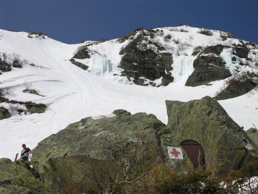
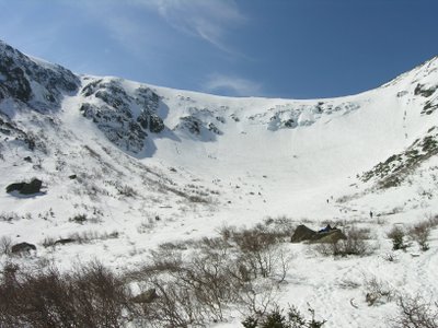
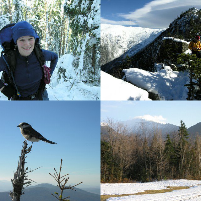
We started hiking at 10:00am. The trail was covered in snow from top to bottom. There was only about an inch or two at the base, but progressively more as we climbed. The snow was well packed by all the hikers and the snowcats that go up the trail occasionally. It is 2.4 miles to Hermit Lake shelters and the caretaker’s cabin. Those 2.4 miles are a wide trail that climbs steadily, but never steeply. We had a good group, and we made it up to the cabin without any difficulties. We took a break at the cabin to layer up and grab some food. There were about thirty other people doing the same thing, most of whom had skis or a snowboard.


From the cabin, the trail narrows to a normal hiking trail and climbs a couple steep pitches. We got chilly during our break at the cabin, but the steep pitches warmed us up nicely. After those steep sections, the trail levels out on the floor of the ravine and it is only a short climb up lunch rocks. We took a fairly long break at lunch rocks admiring the steep walls of the ravine. A few people skied down while we were there, but most people were either hanging out at lunch rocks or climbing up the ravine with their skis. There was a bunch of fresh snow (18+ inches that week) that was covered with about an inch of crust. The crust was easy to kick solid steps through and provided a surprising amount of friction. I tried to slide a few times on purpose and didn’t have much luck.

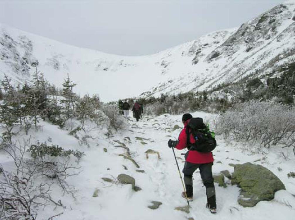
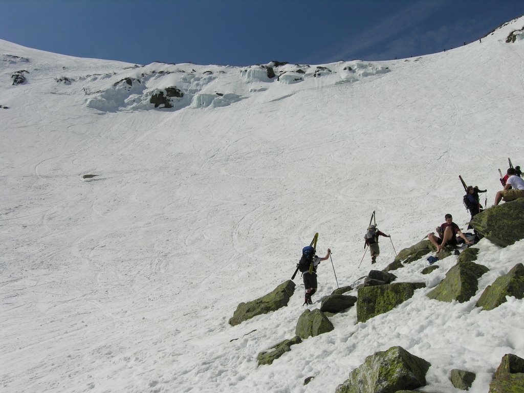
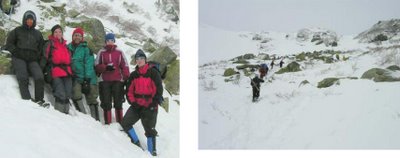
The climb down was fun and fairly uneventful. Pam tried her crampons for the first time, but they kept loosening up on her, so she gave up on them. The size adjustments on the crampons were changing after she put the crampons on. We think the extra piece that stuck out the back due to her relatively small feet (one size fits all crampons) was catching in the snow and changing the size adjustment. The trail wasn’t icy, so she was fine without them.

The descent from the cabin to the trailhead on the wide Tucks trail always seems to go by quickly. The trail allows two, three, or four hikers to walk next to each other easily, which facilitates good conversations. Jodie and Millie enjoy exchanging NOLS and AT stories. They seemed like old friends even though they had just met. And, of course, at some point the conversation turned to food. We decided to head down to Moat Mountain Smoke House and Brewing Co. in North Conway for some food. We reached the trailhead around 3:00pm, checked out the visitor center for a few minutes and then headed to North Conway for dinner.

We had a great hike! Tuckerman’s Ravine in the spring is sort of a cross between hiking and a circus because of all the people. It’s certainly not a hike for those seeking solitude, but it’s a fun hike with breathtaking views nonetheless.

Tuesday, April 04, 2006

Tuckerman Ravine - Mt. Washington, NH

Friday March 31, 2006
Temperatures broke the 70 degree mark in southern NH for the first time this year, and I decided to take the opportunity to head up to Tuckerman ravine. I’m so glad I did! It was absolutely gorgeous! I started hiking from Pinkham Notch around 8:30am and reached the caretaker’s cabin about an hour and ten minutes later. I took a break for a few minutes, grabbed a snack and some water, and was very glad I decided to hike in shorts and gaiters without the polypro.

From the cabin, I headed towards Hillman’s Highway, the prominent gully on the south side of the ravine. I stopped at the base to get out my helmet and ice axe, and then began the long steady climb. I expected the climb to be long, which it definitely is, but I didn’t expect it to be quite as steep as it is. Particularly at the top, the gully exceeds 45 degrees. The gully seems to increase in steepness with every step. To compound the difficulty, the snow got more firm with every step. At the very top, I was basically on all fours kicking steps (very shallow steps) and scrambling up the slope. It’s pretty cool to all of a sudden pop out on flat terrain after climbing something so steep. I topped out at 11:15, took a break for awhile, and then hiked around the ravine to right gully. I contemplated going back down Hillman’s because I was feeling pretty wiped from the climb, but the steep, firm snow didn’t make the descent very appealing. I knew the snow would be softer on the other side of the ravine and I wanted to get into the bowl anyway, so Right Gully it was.

It took very little time to hike around the ravine, and after my break I was feeling pretty strong again. I got to the point where the summer Tucks trail climbs out of the ravine and I wondered whether that would be an easy way down. I headed down that way for a little bit until I saw a few skiers and a line of people coming up. I realized I was heading straight for “The Lip”, which looked frighteningly steep, so I decided I better climb back up and look for Right Gully. It was hard to figure out exactly what part of the ravine I was above. I had descended Right Gully a couple years ago in May after climbing Lobster Claw Gully, but I remembered Right Gully wasn’t obvious from above. Soon I came upon a gully heading down into the ravine. I thought it was too soon for it to be right gully, but it looked big and not too steep. I decided to check it out. After testing the snow a little (nice and soft) and seeing where the gully went I decided to give it a go. Close to halfway down, I noticed I was next to a bunch of vertical ice. Now I knew I was definitely not in right gully, but in what I believe is called “The Sluice”. The last thing I needed was for a big chunk of ice to break off in the warm sun, and if I continued straight down toward Lunch Rocks I would be in the ice fall zone for awhile. So, I traversed as quickly as possible below the ice towards Right Gully. Now safely out of the ice fall zone, I cruised down the bottom of Right Gully with a sitting glissade before finishing it of with a stylish standing glissade. I mingled around Lunch Rocks for awhile taking some pictures and watching the skiers, including one guy who jumped off one of the smaller waterfalls on the headwall and then tumbled down to the base of the ravine (to resounding cheers, of course).

The hike down from the ravine was more interesting than usual. Just after leaving Lunch Rocks, I passed a yellow lab a little bit in front of a hiker. The lab seemed to be trekking straight up the trail and not really paying attention to the guy, but I didn’t think too much about it. Then when I got down to the caretaker’s cabin, an older woman (70s?) asked if I had seen a dog. I told her I had, and then she said, “Well, why didn’t you tell it to come back here. That’s my dog.” I told her it was near some guy so I assumed it was his dog. She said her husband had gone up there to get the dog. I took a break for a little while and then continued down. Shortly, I caught sight of an older women (70?) hiking down the trail. She had hiking poles and was actively sliding with her trail running shoes at all the slippery spots. She was moving pretty well and it took me awhile to catch up with her. We then hiked down the rest of the trail together at a brisk pace. She has been retired for ten years and lives in Berlin, NH. Obviously, she is still very active and agile. It made me hope I’m in such good shape in 50 years.

It took about an hour to descend from Lunch Rocks to the trailhead. I was down around 2:00pm.
Distance: 6.5 miles
Elevation Gain: 3600 ft
Time: 5.5 hrs

Monday, April 03, 2006

Pack Monadnock (North & South)

Sunday, March 26, 2006

I hiked the last section of the Wapack Trail with some people from work. We started at the northern end of trail and hiked south over North Pack and then South Pack Monadnock. The hike ended at Miller State Park. It was a nice hike. It is rocky in some spots, most notably coming down from South Pack, but overall it's fairly easy. We had a good group of 6 people. Everyone had a good time.

Distance: 5.5 miles
Elevation Gain: 1600 ft
Time: 4.5 hours

Sunday, December 11, 2005

Mt. Jackson (4,052 ft) NH

Randy, Joe, Jodie, and I climbed up Mt. Jackson today via the Webster-Jackson Trail. It was a great day. We had our first snowstorm of the season yesterday. In southern NH, we got over ten inches., but the northern part of the state got significantly less. At the trailhead in Crawford Notch, there was about three inches of fresh snow. The surprising thing was that there wasn’t any snow other than those three inches. I had expected to find a small snow base with a fresh layer on top, but apparently there hasn’t been much snow up in the mountains so far. Or at least nothing that has stayed on the ground. Hiking in fresh snow is always fun, and often the clear calm day after the storm offers incredible views. The day started out a little cloudy with breaks of sun, so I wasn’t sure we’d have the joy of seeing the sparkling sun on the fresh snow from the summit. By the time we reached the summit it had cleared considerably, and we got to see the great view towards Mt. Washington and of other surrounding peaks.

The weather was seasonably cold with very little wind on top. The trail is pretty moderate, alternating a few short steep sections with level and occasional descending sections. Right below the summit there is a short tricky section where the trail scrambles over some open ledges that were a little icy. There were some icy and tricky sections along the entire trail because the snow pack wasn’t there yet to smooth over the rocks. Overall it was a very fun day. It was nice to hike and group of 4. It is a good size.
Distance: 5.2 miles
Elevation Gain: 2200 ft
Time: 5.5 hours

Sunday, October 30, 2005

Mt. Jefferson (5,712 ft) Attempt, NH

Mt. Jefferson is the third tallest mountain in New Hampshire. It neighbors Mt. Washington, the tallest. Randy, Jodie, and myself attempted to climb Jefferson via the Castle Trail. The Castle Trail is a long route (5 miles) up Mt. Jefferson with 4200 feet of elevation gain. The Castle trail gets its name from several rock protrusions (Castles) along the ridge it climbs.

Mt. Washington had sent several records this month including most precipitation in a single storm and most snow in October. So, I expected to run into a fair amount of snow, but there was even more snow than I expected. There was about 3 inches on the ground at the trailhead and a couple feet around 4,000 feet. The snow was heavy and wet. It was a warm day. It was practically raining despite the clear blue sky because the snow was melting off the trees so quickly. The worst effect of the snow was the number of blow downs. It seemed like every few minutes we were going off the trail to go around another fallen tree. Needless to say, the going was tough and slow. Relatively early into the hike it became apparent that we didn’t have much of a shot at making the summit, but we were still interested in getting up high and getting a nice view. Around 12:30, after 3.5 hours of hiking, we reached a nice viewpoint just below the first Castle. We took a nice break here before heading back down. The viewpoint was very nice. It was warm, but a little windy. Two Grey Jays were trying to get our food. One landed on my outstretched hand. It must have thought I had something good in my hand, but it was empty. A lot of people must feed those birds for them to be so willing to get close to people.

It was nice to get up high even if we didn't make the summit. I've now hiked the entire Castle Trail. I had done the portion above The Link a few summers ago. Castle Ravine looks like an interesting place. I'll have to go there sometime.
Distance: 7.4 miles
Elevation Gain: 3000 ft
Time: 6.5 hours

Sunday, October 23, 2005

Mt. Carrigain (4,700 ft) NH

Jodie and I hiked Mount Carrigain via the Signal Ridge Trail yesterday. It was great! It was so nice to get a chance to go hiking again. It seems like it’s been raining forever. Last weekend, we had some major flooding in parts of the state. The stream crossings were still a little high, but not dangerously so, like I heard they were last weekend.

The Signal Ridge Trail is one of my more favorite trails. The trail is mostly flat for the first couple miles and then climbs at a constant, moderate grade. My favorite part is where it pops out onto the open area on Signal Ridge. The ridge drops off very steeply to the east, and offers great views of the slides on Mt. Lowell and to Mt. Washington. Mt. Washington and the rest of the Presidential Range looked surreal, capped with the season’s first major snow.

Carrigain’s summit has an old fire tower and offers 360-degree views. Carrigain is pretty much in the middle of the White Mountains so basically every major peak can be seen from the summit. The fall colors were past peak, but still provided nice contrast to the evergreens and snow-capped peaks.
Distance: 10.0 miles
Elevation Gain: 3200 ft
Time: 5 hours

Friday, October 07, 2005

Boulder Morty's, NH

Last night I went to Boulder Morty's Climbing gym in Nashua. It was a lot of fun. I hadn't been there in years, and it showed. Back when I was out in Wyoming for a semester, they had a climbing wall at the fitness center, and I would go a couple times a week. I got pretty good. Climbing often is key to developing the grip strength to pull on small holds. I went to Sinks Canyon one weekend and consistently top roped 5.9s cleanly. I even climbed a couple tens. It was a few years ago, and maybe my memory is being nice to me, but I don't remember falling at all there, except on a 5.11. Climbing last night felt good and bad. It felt nice because I still had most of the technique, but I clearly didn't have the strength I once did. I climbed a few 5.7s cleanly when I first arrived, but pretty soon, I got pumped out before reaching the top. I knew I could do the moves, it was just a matter of having the grip strength. The last few years have been very busy with work and class. I'm going to make climbing more of a priority from now on.

Wednesday, October 05, 2005

Mt. Nancy (3,926 ft) NH

I decided to go for a hike Sunday. I planned to hike to Nancy and Norcross Ponds with the BAE Outing Club in November and thought it would be a good idea to pre-trip that route. I tried to run as much as I could. I ran the first couple miles until the Nancy Cascades, where the trail becomes quite steep. I hiked up that section and then continued to run to the end of Norcross Pond. There is a gorgeous view from the ledges at the end of Norcross Pond. It took me about an hour to reach this point. I looked around a little bit and found a rather obvious trail towards Mt. Nancy. The trail is almost more obvious than the real trail when hiking east. I started following the trail and soon came across a National Forest Service sign indicating this was an unmaintained trail. The trail soon became very steep as it climbed pretty much straight up the peak. It reminded me of some of the steep trails we took in the North Cascades during my NOLS course. Most of the steep trails through the woods in the Cascades that I remember were steep descents. Ascending is tough, but the steep descents, like the knee-busting descent of Kindy Ridge, with 50-70 pounds are much tougher. Coming down from the summit of Nancy was steep and tough going, but not too bad because I didn’t have much of any weight on my back. The trip back to the trailhead was fine. I ran most of the way. I only hiked some of the steepest sections. I had several minor tweaks of my ankles and one fairly descent twist to my left ankle that almost caused me to fall down. Fortunately, the twist didn’t do much damage. Running up the trail was harder than I anticipated. The whole trip was a lot of fun. The running was a nice change of pace from the roads. I had to pay more attention to my feet than normal. Sometimes, particularly when descending, it took more effort to keep my feet moving quickly over the uneven terrain than the actual running. The entire trip was 2 hours and 40 minutes. I think I found the beginning of the “trail” to Mt. Bemis. Right after the first crossing of Nancy Brook there is a fairly distinct trail that breaks off to the right.

Sunday, September 18, 2005

Uncanoonuc Mountain (1,324 ft) NH

Today, Jodie, Erika, and I hiked up North Uncanoonuc Mountain. The Uncanoonucs are just outside of Manchester. It was a short hike; it only took us about an hour to hike up and down. Erika brought her dog, Papst. I had never hiked with a dog before, but it was fun. Papst is very well behaved. The trail was wide the whole way up. We even passed a couple ATVs going up when we were on our way down. It took us awhile to find the trailhead. We found Mountain Rd in Goffstown easily, but drove by the trailhead the first time. There is a good sized dirt pull off on the east side of the road near the trail. There is no trail sign or anything. I might go there again in the near future and run up and down. I think that would be a good workout. My running has hit a bit of a snag the last few weeks. It's been tough being away for LDC and then having classes at WPI start up again. I have decided to rearrange my running schedule to run M, W, F, Sat, Sun rather than the M, T, W, R, F, Sat schedule I had been doing. It's too hard to get up early on Tues. and Thursdays now that I get home from class late and it's so dark out. I ran a nice 9 miler today. Down along the abandoned railroad bed near Lake Massabesic.